
The
The result is a picture of the
resemblance between the anatomy and the landscape.
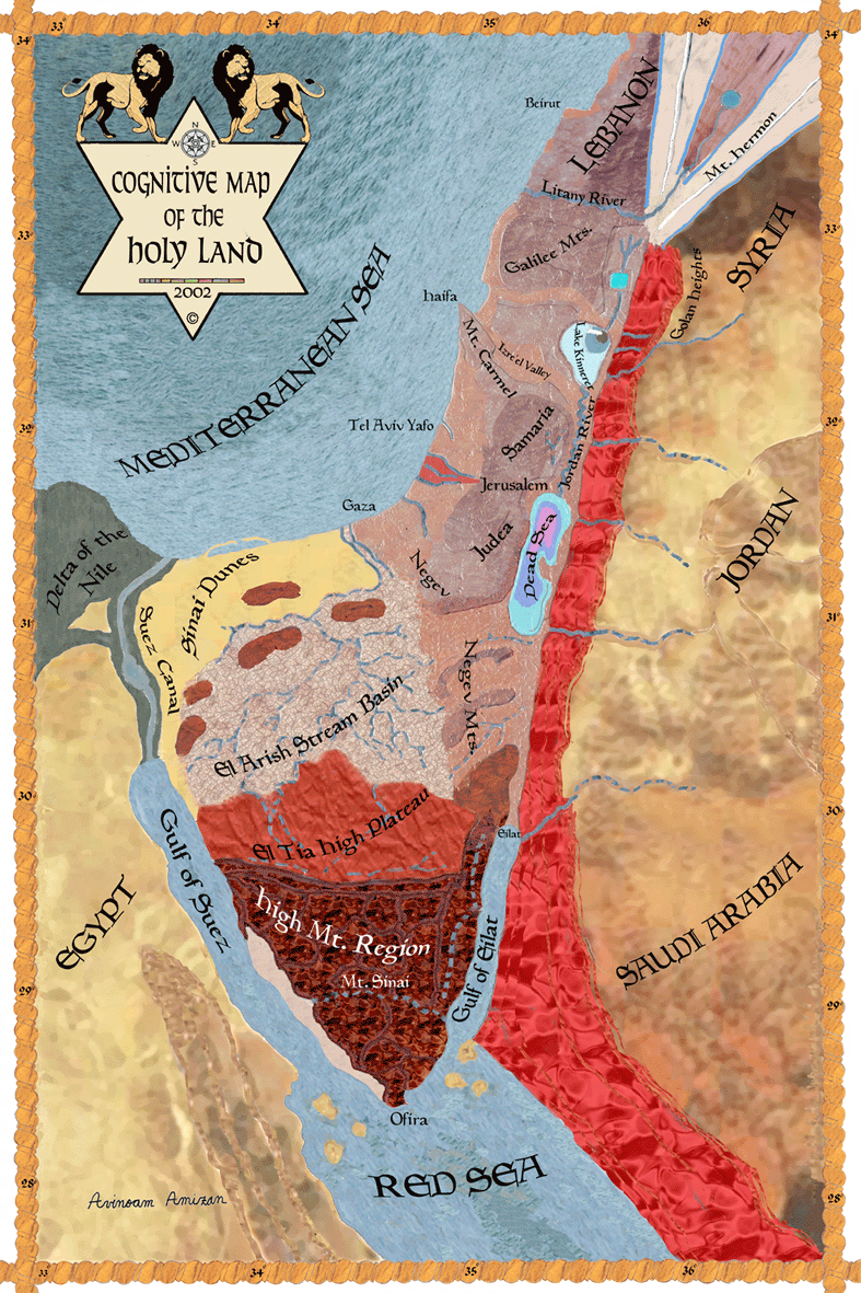
The map is
a combination between satellite photos, anatomy models and historic tales
An earlier map, where the character is
more defined, is represented below.
![]()
The correlation is so clear, that the
landscape can serve as a model for anatomy lessons. The face is the land
between the
When drawing the lines exactly on a
physical map, the outcome is an 'embryonic' character. A free hand drawing can
show a more realistic character.
The face organs of the portrait appear
in an external appearance. The torso organs appear in their internal
appearance. This is in accord with the biblical meaning of the desert as a
place of inspiration and revelation, and the fertile land as a place where
moral laws come instead of the direct inspiration.
The face part of the portrait is
relatively long and the torso part is relatively wide. The artistic elongated
form has a great influence on thought. It creates the illusion of flight. It
reaches upward toward heights and light. It is an image where the formal
imagination and dynamic imagination intermingle, until the words become worn
out. The elongated form is a formal daring. In the formal daring, the dynamic
imagination regains its role as an inventor of shapes. The
![]()
The illustration below shows the
correlations between the body and the map.
Near every body organ appears the geographic
region name to which it is associated.
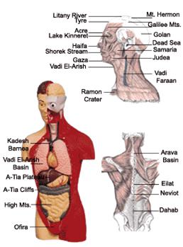
Parallels
between the human body and the Geographic regions of
A Link to
anatomy tutorials and a Link to satellite photos
![]()
Here is an earlier drawing, with more
human characteristic lines. It illustrates the development of the portrait. With
more details the look becomes more Geographic.
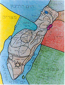
Early
drawing of the holy land map as a human shape
![]()
Previous Page Main Page Next Page