Human Shape of the Holy Land
Chapter 8 - Anthropomorphic Maps of Israel
The

The
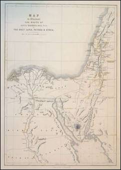
A Map of the painter Roberts
journey to the
Some of the
maps were used for understanding the Bible which is full of Geographic
landmarks.
In Judaism
sources there are only few drawings. Rashi drew in the 11th century the
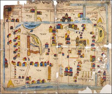
Gaon Mevilna –
The first known
geographic anthropomorphic map included the
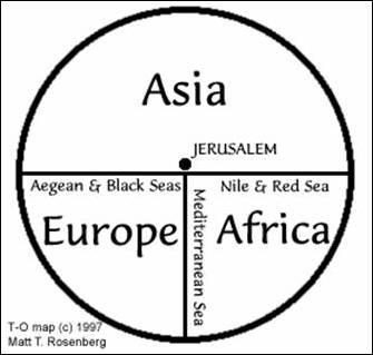
A schematic T-O map
The
cartographer Heinrich Bunting [1545-1606] was a contemporary of Merkator and
![Bunting – The Near East as Pegasus [detail] – 16th century](http://www.library.yale.edu/MapColl/pegasus.GIF)
Bunting – The
A search in
the Internet revealed two new anthropomorphic maps of
The Holy Land as a penis
The painter
of the world coloring maps drew
A coloring map of
In the
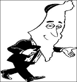
Israeli media anthropomorphic maps of the state are almost unknown. One is by Israel
National Council for the Prevention of Accidents.
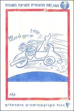
A rare anthropomorphic map of
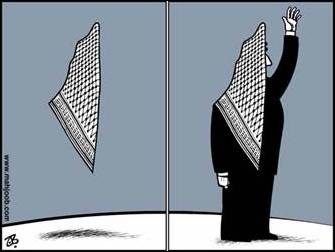
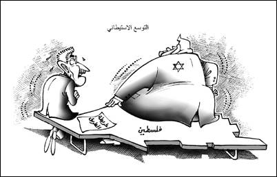
In the Arab
world there are many caricatures dealing with the Israeli-Palestinian conflict.
Some from the last years describe
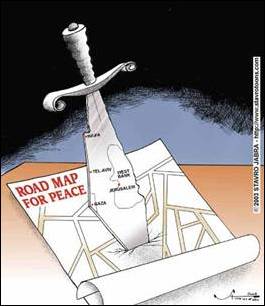
The
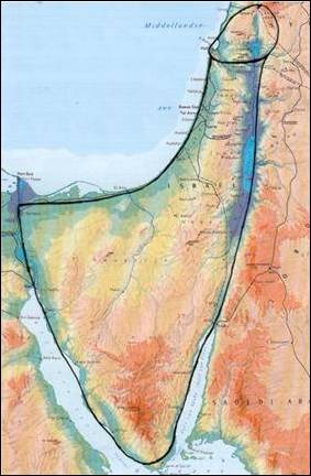
anthropomorphic map of the Holy Land which was created by the author of this book, is in the highest levels of Anthropomorphism and
correlation with the landscape. It is based on many comparisons between
anatomic models and satellite photos, and on the Bible and country stories.
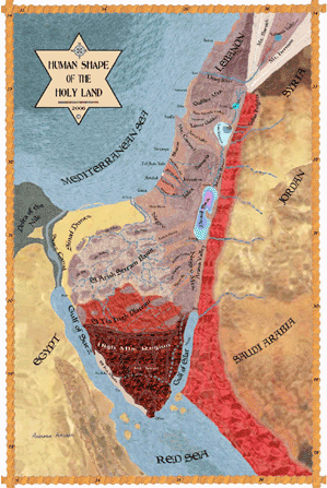
The Holy Land Map as a Human Shape - 2007
![]()
Summery
Anthropomorphism,
the attribution of appearance and qualities of human beings to animals and
inanimate, is very common in all world civilizations as a mean of expressing
ideas. All the religions use this principle at the daily level. The development
of computer and robotic technology create a bigger need of it for optimizing
the connection between man and machine.
The huge
popularity of Anthropomorphism is because the human body is a major focus of
attention concerning health, nutrition and nurturing. The human body is a
microcosm where the big outer world is reflected. Historic collaboration exists
between Medicine men and artists for illustrating Anatomy by advanced graphic
and contemporary art styles. This is done even by sacrificing the pure
scientific description.
In the arts
there is a great freedom of creativity. Every work of art which integrates man
in landscape is, at the same time, a projected description of the human body
and Anthropomorphism of the landscape. The artistic spirit unites between the
two. The development of new art styles allows bolder representations of this proclaimed
relationship.
Maps are a
very influential medium for delivering culture dependant messages. Antique maps
represented a visual essence of their creators' world view. Although modern map
making utilizes sophisticated measurement instruments, it is still under the
influense of aesthetic design. Even accurate maps are forced to represent
interpretive and tendentious view point.
The first
anthropomorphic maps are the constellations and zodiac maps which are associated
with the universe and world maps of early Christianity. Anthropomorphic maps of
continents and single countries evolved gradually from them. Atlases of this
genre were very successful. Anthropomorphic maps serve occasionally as
caricatures.
The